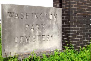
Washington Park Cemetery (W05)
|
4650 James S. McDonnell Boulevard Berkeley, Missouri 63134 314-524-3313 African-American Cemetery Established: 1920 Size: 38.85 acres Burials indexed: 55,982 |
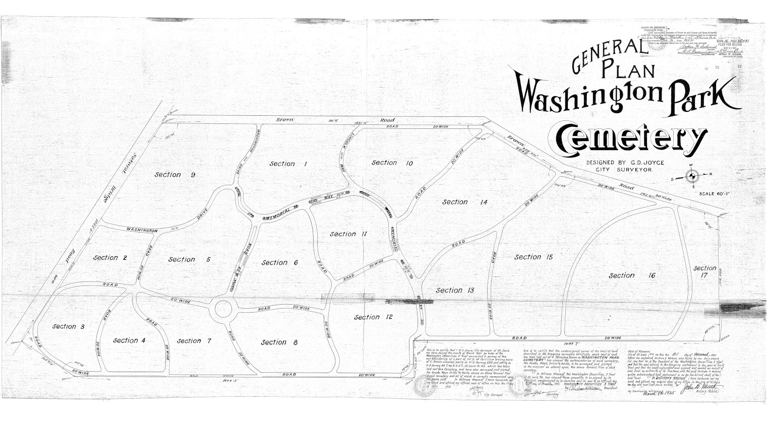 Click on this map to see it georeferenced in a Google Maps interface. Washington Park Cemetery Map courtesy St. Louis County Assessors Office and Kathy Franke. |
|
|
|||
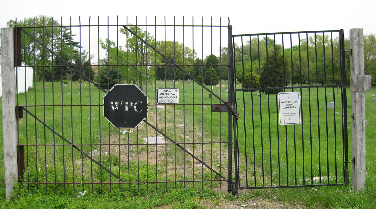
Photos taken by Ilene Murray © 2010; used with permission.
GPS Coordinates: Latitude: 38.7295943, Longitude: -90.3470138 Click here for a Google map to the cemetery.
This once prestigious African-American cemetery has suffered the ravages of time, neglect, gross mismanagement, and disturbances by urban expansion. The graves of thousands of people originally buried here have been moved. Unfortunately, in some cases the final resting place of some people is unknown.
Andrew H. Watson, a lawyer, and Joseph H. Hauer, a member of the St. Louis Real Estate Board, built this large lawn-park cemetery just south of Lambert Airport in 1920 to serve African-Americans in the St. Louis area. The investors incorporated a real estate trust known as the Washington Securities Company. They established the commercial cemetery with a perpetual endowment to provide for its future maintenance. Many investors found this type of investment to be a profitable venture, so it was a popular trend for new cemeteries during this era. The developers hired Joyce Surveying Company to design the new cemetery. Joyce’s company had designed a number of commercial cemeteries, including Memorial Park and Laurel Hill.
Commercial cemeteries were segregated until the civil rights movement in the 1960s. From its creation in 1920 until 1960, the community considered Washington Park to be the most prestigious cemetery in the area for blacks.
Watson and Hauer heavily promoted their new venture by running large advertisements in the St. Louis Argus, a weekly newspaper for African-Americans. The ads described Washington Park Cemetery as a beautiful park and garden cemetery providing perpetual care and maintenance. The salesmen stressed the importance of buying a pre-need cemetery lot to ensure that black people would be able to have a place to be buried in this esteemed cemetery. The perpetual care concept proved to be quite successful as a large number of prominent African Americans chose to be buried here from the 1920s until well into the 1940s.
In 1950, the City of St. Louis closed its last municipal burial ground at 59th and Fyler to make room for a new apartment complex. The city made arrangements to have indigent blacks who were buried there relocated to Washington Park Cemetery, while white indigents were re-interred at Mount Lebanon. In 1952, when the old Wesleyan Cemetery at Hanley and Olive Streets closed, the graves of African-Americans were transferred to Washington Park and white burials were re-interred at Memorial Park Cemetery.
Washington Park cemetery began to decline in the 1950s. Harlan Brown purchased the cemetery in 1955, when the elderly original owners sold the property under a reorganization plan. Encroaching urban expansion also had a negative impact on the cemetery. Construction of Interstate 70 began in 1955 and cut through the north section of the cemetery. In 1972, expansion of runways at Lambert Airport claimed another 8.74 acres of the cemetery.
Harlan Brown transferred the ownership of the cemetery in 1986 to his long-time friend and secretary, Virginia Younger. By 1990, Younger was overwhelmed trying to run the cemetery. As a result, it became a weed-filled, unkempt disgrace. The Missouri Attorney General began an investigation after receiving complaints of gross mismanagement, failure to provide headstones, and reports of improper handling of bodies and gravesites. After being sued by the Attorney General for fraud, Ms. Younger committed suicide, sending the operation of the cemetery into further chaos.
In 1992, the City of St. Louis condemned the north half of the cemetery to make room for the MetroLink light rail system and further expansion of Lambert Airport. The terms of the sale and the mishandling of moving graves from the affected area received considerable negative press at that time. Lucrative contracts were let as part of that project and 14,000 bodies were relocated to other area cemeteries.
The late Ronald Kuper, publisher of the former St. Louis County Watchman Advocate, and his partner, the late Charles Clardy, purchased the south section of the cemetery for $1,928 in unpaid property taxes in 1994. In 2007, Kuper made an appeal for an angel to help save the cemetery. The cemetery has recently been purchased and is slowly being upgraded. Parts of the site still lack proper maintenance, much to the despair of family members seeking to find lost relatives known to have been buried there.
Source of Data for this Cemetery
Volunteers from the St. Louis Genealogical Society transcribed data from copies of the cemetery’s burial cards, which were donated to the society by the cemetery’s previous owner. Some source records contain burial dates that precede the date the cemetery was established. The original cards have since been donated by the society to the Missouri History Museum’s Library and Research Center.
Workers removed graves in the north section of this cemetery as part of the MetroLink and airport expansion project. Those burials and removals are represented below. Some of the names may also appear in those other cemeteries where they were relocated.
Additional Resources
“Airport Seeks Relatives Of Deceased In Cemetery,” St. Louis Post-Dispatch, 2 July 1992.
“Graveyard Delays Work on Metro Link,” St. Louis Post-Dispatch, 9 August 1992, page B1.
“Disturbing the Living And Dead,” St. Louis Post-Dispatch, 15 May 1994, page D1.
“Bodies At Cemetery Removed,” St. Louis Post-Dispatch, 5 April 1997.
“Cemetery Owner is Seeking Savior,” by Tim O’Neil. St. Louis Post-Dispatch, 8 May 2007, page B1.
“Making a Lost Cemetery Holy Again,” St. Louis Post-Dispatch, 17 April 2011, page A23.
“Billboards in Historic Black Cemetery Vex Volunteer,” St. Louis Post-Dispatch, 17 June 2018, page M1.
Old Cemeteries, St. Louis County, Missouri, volume 5 (St. Louis Genealogical Society: St. Louis, Missouri, 2002), pages 109–206.
Cemetery Specific Data Notes
The cemetery Location field combines the section, lot, and grave values from the source as (Section | Lot | Grave). In the Notes field, CAUS indicates cause of death; MORT includes the name of the mortuary; PERM is burial permit; RESI is residence of deceased; SEX is gender of the deceased.

Last modified:
04-Feb-2026 08:32