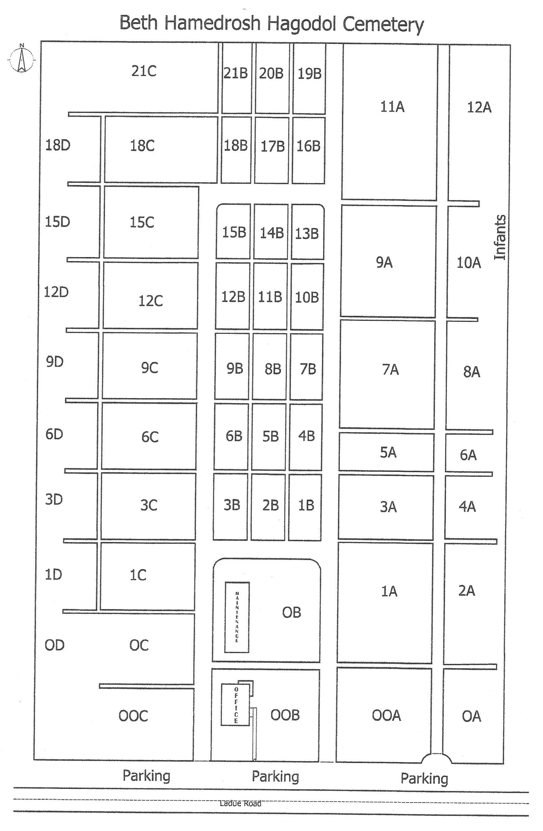
Beth Hamedrosh Hagodol Cemetery (B16)
 Photo taken by Phil Klasskin © 2011; used with permission. |
Beth Hamedrosh Hagodol (“Great House of Learning”) 9125 Ladue Road St. Louis, Missouri 63124 314- 991-0264 Jewish Cemetery Established: 1901 Size: 6 acres Burials indexed: 3,842 (1901–2002) |
 Click on this map to see it georeferenced in a Google Maps interface. Map courtesy of Beth Hamedrosh Hagodol Cemetery Association |
GPS Coordinates: Latitude: 38.654562 Longitude: -90.3662297 Click here for a Google map to the cemetery.
This cemetery has primarily Lithuanian origins. All records are at the cemetery and have been indexed since 1937. The records from 1902 to 1937 were destroyed by fire and have been reconstructed and recorded in plot books which are kept current. Brief accounts of the cemetery are in the golden and diamond jubilee books.
Six acres of land were purchased for a new cemetery on 5 December 1901. The cemetery was and remains limited to those of Orthodox faith, although they may be affiliated with any Orthodox synagogue. The present stone gates were constructed in 1931. A stone chapel was designed for the cemetery in 1936.
General information on Jewish cemeteries and other resources in Missouri:
https://iajgscemetery.org/usa/missouri-mo/
To access the JGS Cemetery Database records by name, please use the Search button on the top menu.
Source of Data for this Cemetery
Data transcribed from plot books by StLGS volunteers.
Cemetery Specific Data Notes
“Cemetery Mitzvah,” in Oy! (A supplement to the St. Louis Jewish Light), December 2018, pages 8–12.
Hamilton, Esley, The Cemeteries of University City. (The Historical Society of University City: University City, Missouri, 1998), page 26.
Additional Resources
None.
Last modified:
06-Jul-2024 22:22
